LiDAR data plays a quiet but critical role in how we understand physical space. From mapping landscapes to supporting advanced spatial analysis, its value depends on how accurately raw point clouds are interpreted. This is where annotation enters the picture. Even small inconsistencies in labeled data can ripple outward, affecting measurements, models, and decisions that rely on them. Quality control is not an optional step in this process; it is the stabilizing force that keeps complex spatial data reliable and useful.
The foundation of accurate spatial interpretation
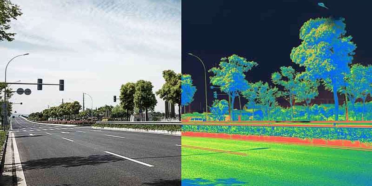
At its core, lidar annotation is about assigning meaning to millions of data points. Each point represents a tiny fragment of the real world, and together they form a detailed three-dimensional view of terrain or structures. Quality control ensures that these points are labeled consistently and correctly, reducing ambiguity in how surfaces, elevations, and objects are interpreted.
Without careful review, errors such as misclassified ground points or inconsistent boundaries can slip through. These issues may not be obvious at first glance, but they can distort elevation models or terrain analyses later on. Quality control acts as a checkpoint, verifying that annotations align with established guidelines and reflect real-world conditions as closely as possible.
Reducing downstream errors and rework
One overlooked benefit of quality control is how much time and effort it saves in later stages. When annotation errors are caught early, they prevent costly revisions downstream. In spatial projects, small inaccuracies can compound, leading to flawed outputs that require significant reprocessing.
By embedding quality checks throughout the workflow, teams can identify patterns of error and address them systematically. This creates a feedback loop where annotation practices improve over time. In the long run, this approach supports smoother project timelines and more predictable outcomes, even as datasets grow larger and more complex.
Supporting consistency across large datasets
Large-scale LiDAR projects often involve multiple contributors and extended timelines. Maintaining consistency across such efforts is challenging without a strong quality control framework. Clear standards, combined with regular review, help ensure that annotations remain uniform regardless of who performs them.
Consistency matters because analytical models rely on predictable input. When annotations vary in quality or interpretation, results become harder to compare or validate. Through structured quality control, lidar annotation remains coherent across regions and datasets, supporting meaningful analysis at scale.
Building trust in data-driven decisions
Spatial data is often used to inform planning, research, and risk assessment. Decision-makers may never see the raw point clouds, but they depend on the accuracy of the processed outputs. Quality control provides confidence that the data has been carefully reviewed and meets defined accuracy thresholds.
This trust is especially important when LiDAR-derived insights are combined with other data sources. Reliable annotation makes integration smoother and conclusions more defensible. Over time, consistent quality practices strengthen the credibility of LiDAR-based analyses as a whole.
Adapting to evolving standards and technologies
As LiDAR technology advances, so do expectations around data quality. New use cases and higher-resolution sensors demand more precise annotation. Quality control is not static; it evolves alongside methods and standards.
Regular evaluation allows teams to refine guidelines and adapt to new challenges. In this way, lidar annotation remains aligned with current needs rather than locked into outdated assumptions. Quality control becomes a living process, supporting continuous improvement rather than a final checkbox.
In the end, quality control is what transforms annotated LiDAR data from a technical exercise into a dependable resource. It safeguards accuracy, supports consistency, and builds confidence in every analysis that follows.